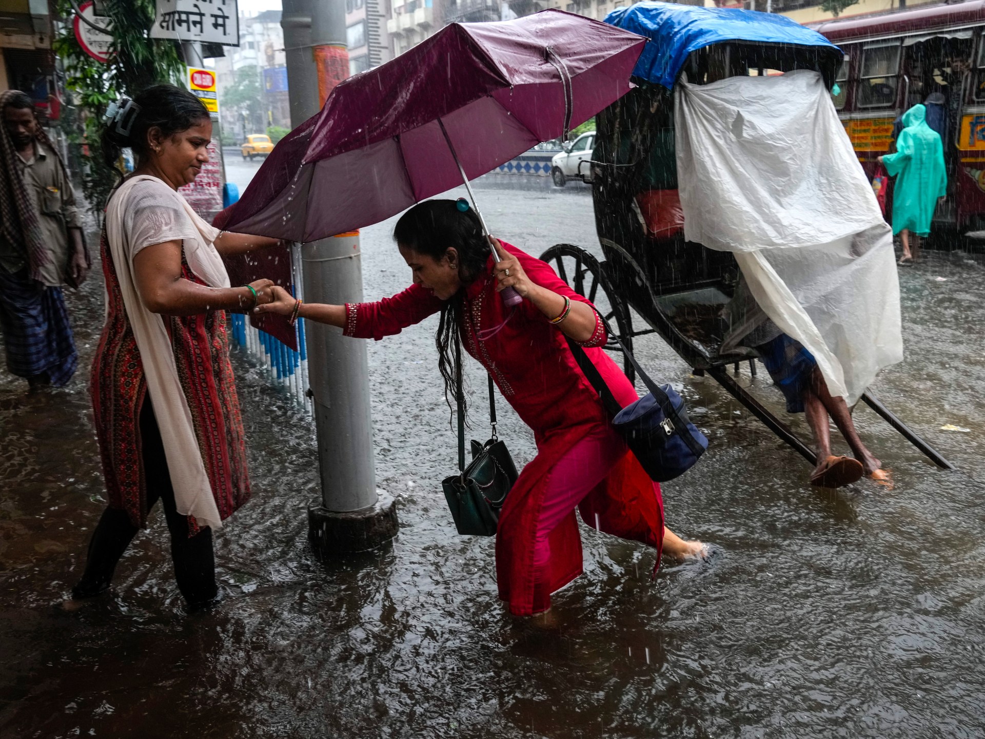
Cyclone Dana made landfall in Odisha state on India’s eastern coast on Thursday night with maximum sustained winds of about 110km/h (68mph), according to the India Meteorological Department. Gusts are expected to reach 121km/h (75mph).
Authorities in India’s eastern states of Odisha and West Bengal were evacuating hundreds of thousands of people from coastal areas overnight as trees were uprooted and houses demolished.
Odisha’s health minister Mukesh Mahaling told the AFP news agency that “nearly a million people from the coastal areas are being evacuated to cyclone centres”. In neighbouring West Bengal, the evacuations of more than 100,000 people began on Thursday, said Bankim Chandra Hazra, a government minister.

The very human practice of giving names to cyclones, storms and hurricanes – despite the devastation they may wreak – dates back to the 1500s, even though we have only become adept at predicting their arrival since the first successful weather forecast in 1950.
With roughly one month left until we reach the end of this year’s hurricane season in the Atlantic region, meteorologists are warning that hurricanes and storms have become more frequent and intense in recent years due to climate change. Rising global temperatures correspond with rising ocean temperatures, which can lead to stronger storms.
According to the National Oceanic and Atmospheric Administration (NOAA), the United States federal agency responsible for monitoring and forecasting global weather events, “The outlook for the 2024 Atlantic Hurricane Season indicates that an above-normal season is most likely (90 percent chance).”
The full list of suggested names to be used between now and 2027 can be viewed on the website of the World Meteorological Organization (WMO) and includes such names as Gaston, Lorenzo, Patty and Idalia. Recently, tropical storm Oscar was named. On Monday, it made landfall in eastern Cuba as it headed towards the Bahamas.
Earlier this month, hurricane Milton hit Florida in the US, leaving more than three million people without power.
Let’s find out how naming storms started and why.

Why did we start naming storms and hurricanes?
Although naming storms was only formalised in the early 1950s by the US National Hurricane Center – with the naming of Hurricane Alice in 1953 – the informal naming of storms started in the 1500s.
Some of the first named storms signalled a nod to Catholic saints, such as Hurricane San Franciso, which hit Puerto Rico on July 26, 1526, and the San Mateo Hurricane of 1565, which hit California. San Mateo was named after the feast day of St Matthew. It is not known who, precisely, chose the names.
Even up to the late 1900s, it was still common to name storms after Catholic saints, with Hurricane San Ciriaco which hit Puerto Rico in 1899 documented as one of the most destructive hurricanes in history, according to the US Library of Congress.
In the late 1800s, an Australian meteorologist by the name of Clement Wragge, who had been appointed as chief weather forecaster by the Queensland government from 1887 to 1902, began the practice of naming storms after women. According to some historians, he also liked to name storms after mythical figures, military leaders and politicians he didn’t like.
Some of these were military leaders such as Persian ruler Xerxes and Carthaginian general Hannibal, while others were Biblical locations such as Ramoth and Teman.
In 1953, the US National Weather Service started to use an alphabetical list of female names for the naming of storms, beginning with Tropical Storm Alice. It is not known who came up with this particular name or why.
However, some women took offence at this. In response to concerns raised by women’s advocacy groups, the practice of using solely female names was retired in 1979. Male names were incorporated into the list, creating a more inclusive and gender-balanced naming system.
At the time, Roxcy Bolton, a prominent women’s rights, activist stated: “Women deeply resent being arbitrarily associated with disaster.” In 1979, the first storm to receive a male moniker – Bob – was named. Again, it is unclear precisely who chose this particular name or why.
How are storm names chosen?
A storm must reach winds of least 64km/h (40mph) to earn itself a name.
The World Meteorological Organization (WMO), located in Geneva, Switzerland, has 193 member states and territories and has been responsible for naming storms since 1953.
The WMO maintains a rotating set of six lists, using English, Spanish and French names, due to these being the primary languages spoken in the Atlantic Basin, which covers the North Atlantic Ocean, the Caribbean Sea and the Gulf of Mexico. This Atlantic Basin area is roughly 106 million square kilometres (41 million square miles) in size.
In general, hurricane names are chosen to represent the language most widely spoken in those areas affected by the storm. This ensures that those individuals in hurricane-prone areas can quickly identify the storm through their primary language.
Some 21 names are on each list in alphabetical order and are rotated every six years, excluding letters Q, U, X, Y, and Z due to the difficulty of finding suitable names beginning with those letters.
The creation of the lists and selection of names is carried out by a WMO committee. Each name chosen for inclusion is at the committee’s discretion, but the general criteria is that the name should be easy to pronounce.
Why do we name storms?
The main reason for naming storms is to increase awareness while improving communication to the public on what’s happening with a particular storm, including landfall time, storm movements, and the storm’s possible lethality.
According to a recent article from the NOAA, “The use of short, easily remembered names in written as well as spoken communications is quicker and reduces confusion when two or more tropical storms occur at the same time.”
If a hurricane or typhoon is extremely destructive, the WMO will retire the name from being used on any future hurricanes. According to The Weather Channel in the US, some 96 names have been retired since March 2023. These include names that invoke terrible disasters such as Katrina (the name of the 2005 hurricane which wreaked devastation in New Orleans and its surrounding areas, killing nearly 1,400 people) and Harvey (the storm which made landfall in southern Texas in 2017, killing more than 100 people.)
Do countries other than the US name storms?
Yes. In 2015, the United Kingdom started its own storm-naming system, which is now maintained by the UK’s Met Office and by Met Eireann, the weather service in the neighbouring Republic of Ireland. The first storm to be named in the UK was Abigail, in November 10, 2015.
Unlike the US naming system, the public can suggest names to the UK Storm Centre to be considered in future lists. Babet was the first publicly suggested name, used for the 2023-24 storm season.
Other countries that name storms include Spain, Belgium, Luxembourg, France, Portugal and the Netherlands.

How do we know storms are on the way?
The method of predicting the onset of storms has evolved exponentially in the past 100 years.
In the early 20th century, meteorologists employed a range of basic observational methods and instruments to forecast storms. Barometers were used to measure atmospheric pressure and anemometers were used to measure wind speed and direction. The telegraph – “the internet” of the 1900s – was used to communicate weather observations from weather offices in various locations.
Today’s more sophisticated technology allows most tropical storms to be quickly identified using powerful weather satellites. Modern satellites show high-resolution images of storm movements and patterns in real time, allowing for early warnings before storms fully develop.
The Doppler radar system, a weather radar technology, sends radar pulses of electromagnetic energy into the air towards a cloud from a ground satellite to detect precipitation and its level of intensity.
The radar can detect precipitation type – snow, rain, or hail. The radar system provides a location of the precipitation, the speed of the precipitation’s movement and droplet size.
In addition, weather planes, known as Hurricane Hunters, fly directly into storms to record real-time data on wind speed, pressure, temperature and humidity.


